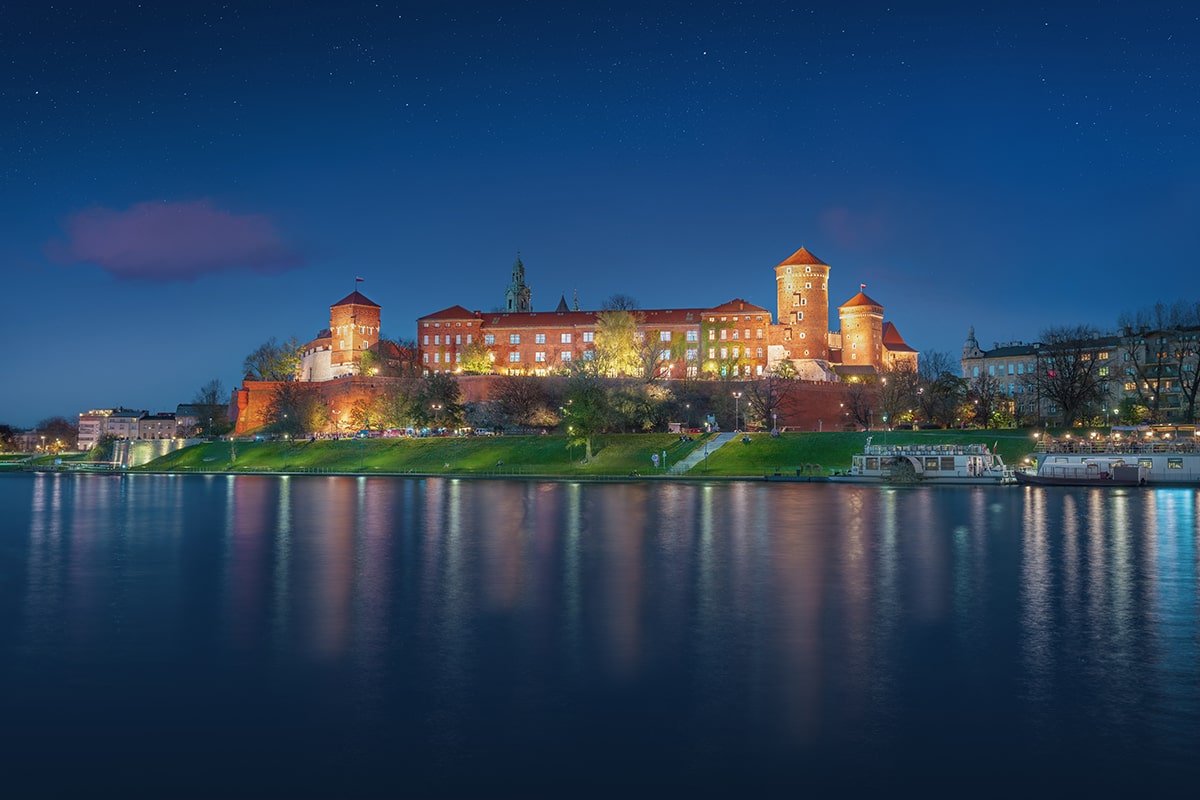
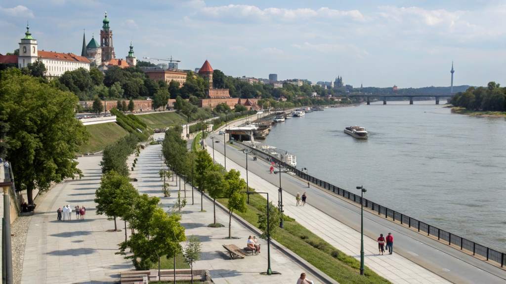
Wawel Castle Embankment
Morning or golden hour
Capture the castle walls reflecting on the water surface from the lower boulevard level.

Travelers navigating the city's layout frequently use the central waterway to orient themselves between districts. This What River Runs Through Krakow guide details the Vistula's historic route beneath Wawel Hill and outlines how to explore its public boulevards.
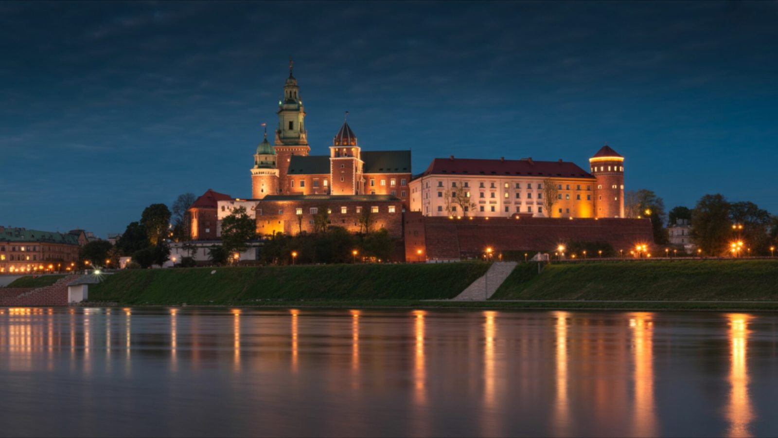
Quick answer
The Vistula River (Wisła) is the waterway that runs through Krakow, featuring public riverbanks and walking paths that are entirely free to access 24 hours a day. The channel flows directly beneath Wawel Castle, cleanly separating the historic Old Town and Kazimierz districts on the north from Podgórze to the south.
At 1,047 kilometers in length, the Vistula is the longest waterway in Poland, originating in the southern Beskid Mountains and eventually emptying into the Baltic Sea. When visitors ask what river runs through Krakow, they are inquiring about a body of water that historically dictated the exact placement of the medieval Polish capital. Before modern engineering and flood controls altered its banks in the early twentieth century, the river frequently inundated the surrounding floodplains. These seasonal wetlands provided natural defensive barriers for the early royal settlements built upon the high ground of Wawel Hill. Today, the channel is highly regulated, offering a calm, flat surface that clearly mirrors the limestone fortifications towering directly above the embankments. The Wisła waterway actively divides the urban center into distinct northern and southern zones, functioning as a primary navigation landmark for pedestrians. On the northern bank, the historic Old Town and the former Jewish quarter of Kazimierz slope gently down toward the water. To the south lies the Podgórze district, characterized by its nineteenth-century industrial heritage and the prominent limestone cliffs of Krzemionki. Connecting these neighborhoods are several essential crossings. The low-slung Dębnicki Bridge provides uninterrupted sightlines toward the royal castle, while the Father Bernatek Footbridge serves as a dedicated pedestrian and cycling link that carries heavy daily commuter traffic between Kazimierz and Podgórze. Because access to the paved paths lining the water remains entirely free and open at all hours, the Vistula Boulevards serve as the city's largest linear park. Wide concrete and stone embankments parallel the riverbed for several kilometers in both directions, separating loud urban vehicular traffic from the quiet pedestrian zones located below street level. Shallow-draft barges and flat-bottomed passenger vessels utilize the regulated depth of the channel for daily transit. Meanwhile, numerous stationary boats moored permanently along the Czerwieński Boulevard function as floating restaurants and cafes. Understanding the geography of Krakow's central river and knowing exactly what river runs through Krakow helps structure any pedestrian itinerary, especially for those planning to walk the banks or board a vessel near the Grunwaldzki Bridge to view the medieval architecture from the water level.
“Before modern engineering altered its banks, the seasonal wetlands provided natural defensive barriers for the early royal settlements on Wawel Hill.”
The Vistula River serves as the central waterway of Kraków, functioning as both a historical backbone and a modern leisure corridor for the city. It is the longest river in Poland, winding through the heart of the capital of the Małopolska region.
The Vistula is the longest river in Poland, originating at Barania Góra in the Beskid Mountains and flowing north to the Baltic Sea.
The river flows directly beneath Wawel Hill, where the historic royal residence and cathedral have stood for centuries as a symbol of Polish statehood.
The Vistula historically separated the city center from districts like Podgórze, influencing the urban development patterns visible in Kraków today.
Kraków's Old Town, which borders the Vistula, was one of the first sites inscribed on the UNESCO World Heritage list in 1978.
The Vistula drainage basin covers approximately 194,000 square kilometers, which accounts for more than half of Poland's total land area.
The Vistula Boulevards, spanning the riverbanks within the city, function as public infrastructure for walking, cycling, and leisure activities.
The Vistula River flows directly through the center of Krakow, with the Vistula Boulevards providing the most accessible public entry points. The riverbanks are reachable via various transit hubs throughout the city.
Lines 1, 6, 8, 10, 13, 18, 22 to Wawel stop
Lines 103, 114, 124, 144, 173 to Jubilat stop
From Main Market Square (Rynek Główny) via Grodzka Street
The optimal arrival window is 08:00–19:00 for walking along the Vistula Boulevards. Arriving at the Wawel stop places you within a short walking distance of the primary river access points.
The public riverbanks of the Vistula River are accessible to visitors 24 hours a day, seven days a week. These walking paths remain open throughout the entire year.
The best arrival window is 08:00–19:00, which offers optimal daylight for walking along the Vistula Boulevards. Visiting during these hours provides sufficient visibility to appreciate the river's path through the city center.
Mild, 15°C to 22°C. Ideal temperatures for extended walks along the banks.
Summer (July-August)
Cool, 10°C to 17°C. Lower humidity and stable conditions for river observation.
—. These periods allow for a quieter experience on the paths before daily crowds gather.
Verdict: The optimal time to experience the Vistula River is during weekday mornings in May or September, arriving within the 08:00–19:00 window.
Morning or golden hour
Capture the castle walls reflecting on the water surface from the lower boulevard level.
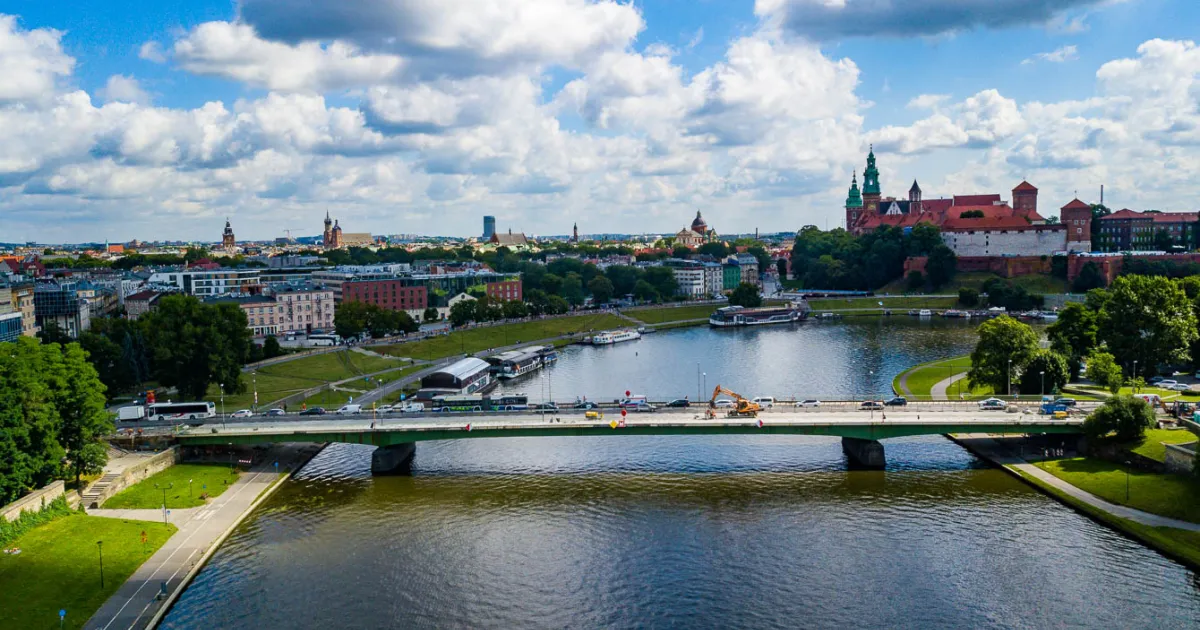
Late afternoon
A straight-on view of the bridge framing the river path with the castle in the background.
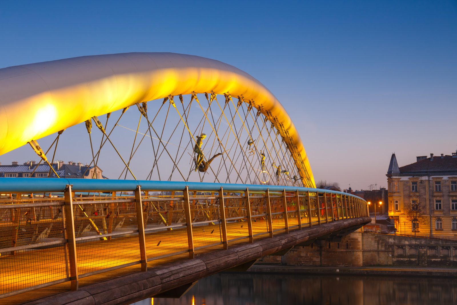
Evening lighting
Photograph the intricate arch structure and the pedestrian path connecting Kazimierz and Podgórze.
08:00–19:00
Use the walking paths to frame the river winding through the urban landscape.
Everything you need to know about what river runs through krakow
The Vistula River is the waterway that flows through the heart of the city. Understanding what river runs through Krakow helps visitors navigate the central boulevards and historic waterfront districts effectively.
There is 0 PLN entrance fee to access the public riverbanks and walking paths. Visitors can enjoy the scenic Vistula Boulevards freely at any time of day or night.
The best arrival window is 08:00–19:00 to experience optimal daylight for walking along the Vistula Boulevards. This time frame allows you to see the landmarks clearly while enjoying the river scenery.
Yes, the Vistula Boulevards offer extensive paths perfect for pedestrians and cyclists along the banks. These trails are a popular way to discover what river runs through Krakow while staying close to the city center.
Many visitors choose to experience the waterway via an evening cruise to see the Wawel Castle and city illumination from the water. You can browse available cruise options to plan your evening journey on what river runs through Krakow.
The Vistula, or Wisła in the local language, serves as the main artery for river tourism and leisure. Whether you are walking the banks or taking a boat tour, this UNESCO heritage-adjacent waterway is central to the local experience.